Planning to buy waterfront acreage in 34994 and wondering what you can build on the water? You are not alone. Riparian rights and dock permits in Martin County can feel complex, especially when you compare riverfront parcels with inland canals or lakes. This guide breaks down what you own, what the state controls, how permits work, and what to check before you buy so you can protect access, value, and long-term enjoyment. Let’s dive in.
Riparian rights in Martin County
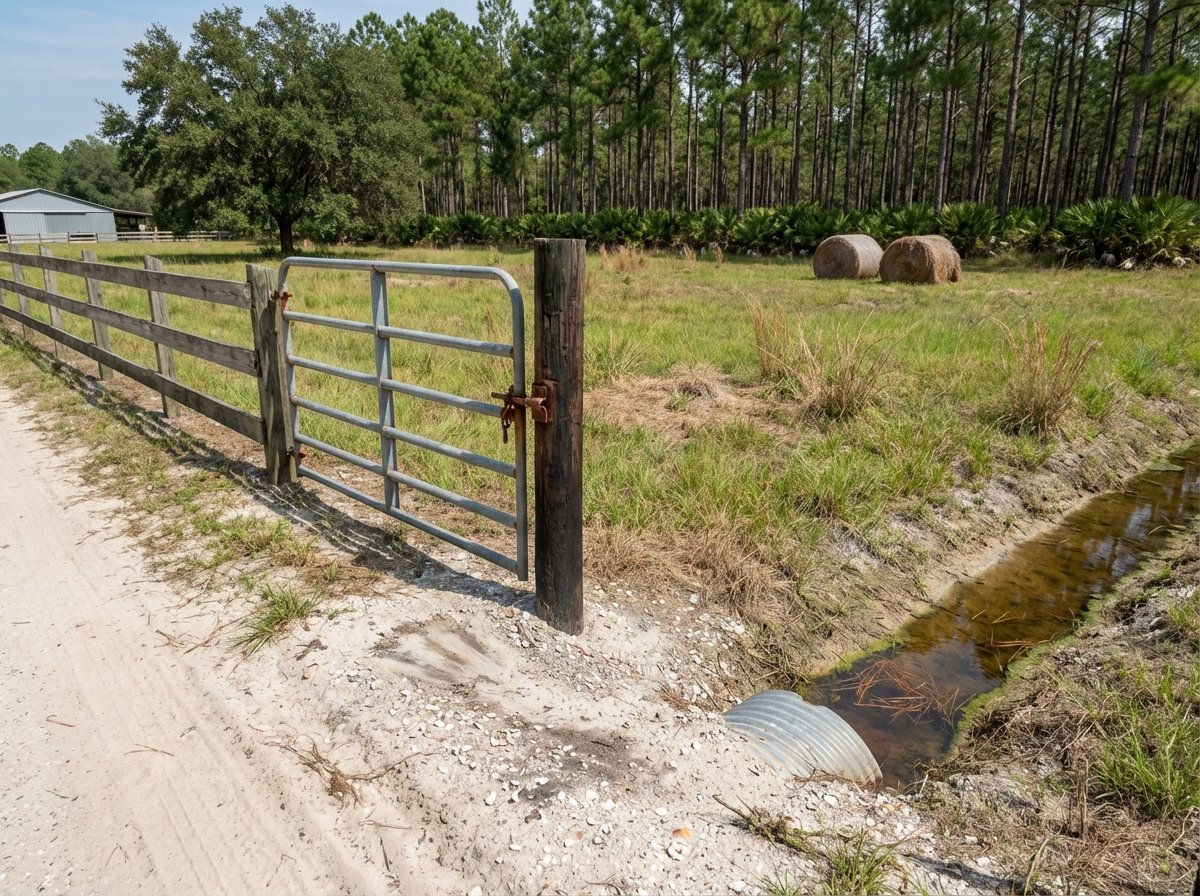
Riparian rights are the set of property interests that attach to upland land that borders water. In Florida, this typically includes reasonable access to the water for navigation and mooring, plus the ability to wharf or dock subject to public trust and environmental rules. These rights do not guarantee you can build anything you want. They sit alongside state ownership of certain submerged lands and multiple layers of environmental and navigation laws.
In many parts of Martin County, the State of Florida owns sovereignty submerged lands below the mean high water line on tidal waters or below the ordinary high water line on navigable freshwater bodies. Using those submerged lands often requires authorization from the Florida Department of Environmental Protection. If your project involves wetlands or surface waters, the South Florida Water Management District may also be involved. Federal approvals from the U.S. Army Corps of Engineers can apply when navigable waters or wetlands are affected.
What does this mean for you as a buyer? Owning shoreline does not equal an automatic right to dredge or build a dock. You will likely need a current survey that shows your upland boundary and the appropriate water line, and you should expect that state, federal, and county permits could be required for new or expanded in-water structures.
Riverfront vs inland waterbodies
Riverfront parcels
If you are looking at the St. Lucie River or the Indian River Lagoon, plan on a higher level of regulatory involvement. Submerged lands in front of your parcel are often state owned, which brings FDEP authorization into play. These estuarine systems commonly support mangroves, seagrass, and oyster bars, all of which are highly regulated and can shape dock design, location, and feasibility.
Navigation is a plus on tidal rivers, with broader channels and access to larger waterways. That said, you must avoid encroaching into navigation channels and respect public navigation rights. Tides, currents, and storm exposure influence materials and piling design, and saltwater conditions affect long-term maintenance.
Dredging on tidal rivers is often difficult to permit due to habitat sensitivity. If dredging is even possible, expect more extensive review and potential mitigation.
Inland lakes and canals
Inland settings can be more straightforward for simple docks, depending on the specific waterbody. Some man-made canals are not state sovereignty lands, while navigable lakes may be. SFWMD rules still apply where wetlands or surface waters are affected, and Martin County will review local standards.
Ecological considerations are different but still important. Freshwater wetlands and littoral shelves are regulated. You may also need to plan around invasive aquatic plants and water depth variability. Without tides, dock heights and lift choices differ, and some inland waters have limited boating access due to culverts, locks, or lack of direct connection to open water.
How the differences affect your decision
- Riverfront parcels often deliver wider navigation and lifestyle benefits but come with a higher chance of multi-agency permitting and environmental constraints.
- Inland or canal-front parcels may offer simpler permitting for modest docks but could limit boat size or travel routes.
- The presence of mangroves, seagrass, or oyster habitat in front of a parcel is a major factor in whether and where you can build, and how long approvals will take.
If “dockability” is central to your plan, verify the waterbody type, ownership of submerged lands, and habitat conditions before you commit.
Permit pathway: who does what
Most dock projects follow a similar pathway, with reviews running in parallel. The exact route depends on your waterbody, design, and whether you are dredging or affecting sensitive habitats.
- Martin County: Building and local environmental permits, plus zoning and dock design standards. Expect to provide site plans, drawings, and coordinate with utilities or septic where applicable.
- Florida Department of Environmental Protection (FDEP): Authorization to use sovereignty submerged lands when work occurs below the applicable high-water line. Dredge-and-fill or coastal permits may apply.
- South Florida Water Management District (SFWMD): Environmental Resource Permits when wetlands, surface waters, or flow are affected. Certain minor docks may be exempt, but dredging or shoreline changes often require review.
- U.S. Army Corps of Engineers (USACE): Section 10 and/or Section 404 approvals for navigable waters and wetlands. Some docks qualify for nationwide permits; more complex work takes longer.
- Other stakeholders: Florida Fish and Wildlife Conservation Commission may provide guidance on protected species and habitat. Homeowner associations and covenants can add project-specific rules.
What your application needs
You will move faster if you gather the common materials early. Typical submittals include:
- A current boundary survey showing upland lines and the ordinary or mean high water line.
- A site plan and scaled dock drawings with dimensions, pilings, materials, and clearances.
- Cross-sections and elevations for tidal projects.
- Ecological surveys when mangroves, seagrass, oysters, or submerged vegetation may be present.
- Composite permit applications for county, FDEP, SFWMD, and USACE, plus fees.
- Neighbor notifications or public notice documentation if required.
- For dredging: hydrographic survey, volume calculations, disposal plan, and mitigation plan if needed.
Timelines and what slows approvals
Simple replacements that do not expand a permitted footprint and avoid sensitive habitats can move in 1 to 3 months. New docks in sensitive areas, dredging, or projects that need multiple agency approvals can take several months to a year. Agency workload, completeness of your application, and design changes all affect timing.
Common slow-downs include missing surveys, unclear ownership at the water line, habitat conflicts that require redesign, or proposals that encroach into navigation areas. Pre-application meetings can help you resolve issues early and set realistic expectations.
Common constraints to expect
- Size and length limits based on lot frontage and local standards.
- Setbacks from property lines and navigation channels.
- Pile spacing and anchoring for storm resilience and safety.
- Strict limits on dredging near seagrass, oyster bars, and within the Indian River Lagoon system.
- Avoidance, minimization, and mitigation requirements where habitat impacts are unavoidable.
- Different treatment for routine maintenance versus new construction or expansions.
Pre-purchase checklist
Use this quick checklist before you go under contract on waterfront acreage in 34994:
- Order a current boundary and flood-elevation survey that shows the relevant high-water line.
- Ask the seller for copies of existing dock permits, surveys, and as-builts.
- Request a pre-application or waterfront-use inquiry with Martin County where available.
- Review maps and site conditions for mangroves, seagrass, oysters, and other sensitive habitats.
- Confirm any HOA or covenant restrictions on docks, lifts, or bulkheads.
- Check FEMA flood zone and base flood elevation, plus shoreline erosion history.
- Consider a pre-purchase feasibility review by a qualified surveyor, coastal engineer, or environmental professional.
- Budget for design, surveys, mitigation, and multi-agency permit fees.
Special local factors
Mangroves and shoreline vegetation
Mangroves are protected, and trimming or removal is regulated. Expect that any alteration will require authorization and may include mitigation or strict trimming practices. Counties can also have enhanced local standards.
Seagrass and oyster habitat
Seagrass beds and oyster bars are common in Martin County estuaries. Projects that affect these habitats usually require you to avoid and minimize impacts first. If impacts remain, mitigation can add time and cost.
Dredging and disposal
Dredging in the St. Lucie River and Indian River Lagoon system faces high scrutiny. You will need an approved disposal plan and may encounter limits that make dredging infeasible in certain areas.
Storm resilience and insurance
Tidal surge, waves, and saltwater corrosion shape dock design. Local building codes and insurers may require certain elevations, anchoring, and materials. Choosing robust materials early can improve longevity and approval outcomes.
Your next steps in 34994
- Get a licensed survey that shows the ordinary or mean high water line and any encroachments.
- Gather available permits and as-builts from the seller and confirm with Martin County records.
- Set a pre-application call for complex sites to align with county, FDEP, SFWMD, and USACE expectations.
- Weigh riverfront benefits against permitting complexity versus inland convenience and navigation limits.
If you want parcel-specific guidance on riparian rights, submerged land status, and likely permit pathways, reach out to the local land specialists who live this work. Start a tailored review with Pioneer Land | Hunting | Ranches | Conservation.
FAQs
What are riparian rights for 34994 waterfront owners?
- They include reasonable access to the water and the ability to wharf or dock, subject to state ownership of submerged lands and multi-agency permitting.
Do I automatically have the right to build a dock in Martin County?
- No. You typically need approvals from Martin County and often FDEP, SFWMD, and the U.S. Army Corps depending on location and scope.
How do I tell if the bottom in front of my parcel is state owned?
- Get a current survey that shows the applicable high-water line and consult with permitting records; agency review can confirm sovereignty submerged lands.
Will an existing dock be grandfathered if I buy the property?
- If it was lawfully permitted, it is typically allowed to remain; unpermitted structures can trigger remediation or require retroactive authorization.
How long do dock permits take in Martin County?
- Simple replacements may move in 1 to 3 months; new docks with habitat issues or dredging can take several months to a year.
What makes riverfront docks harder to permit than inland docks?
- Tidal habitats like mangroves, seagrass, and oyster bars are common on rivers and estuaries and receive strict protection, increasing review and design constraints.